Underground nuclear tests are hard to detect. A new method can spot them 99% of the time

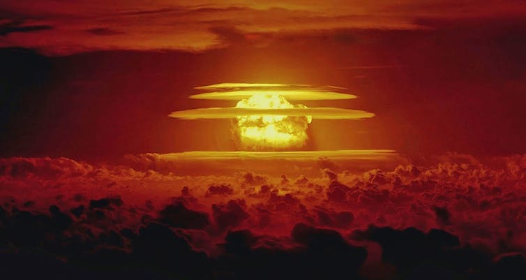
Since the first detonation of an atomic bomb in 1945, more than 2,000 nuclear weapons tests have been conducted by eight countries: the United States, the Soviet Union, the United Kingdom, France, China, India, Pakistan and North Korea.

Groups such as the Comprehensive Nuclear-Test-Ban Treaty Organization are constantly on the lookout for new tests. However, for reasons of safety and secrecy, modern nuclear tests are carried out underground – which makes them difficult to detect. Often, the only indication they have occurred is from the seismic waves they generate.

In a paper published in Geophysical Journal International, my colleagues and I have developed a way to distinguish between underground nuclear tests and natural earthquakes with around 99% accuracy.

Fallout

The invention of nuclear weapons sparked an international arms race, as the Soviet Union, the UK and France developed and tested increasingly larger and more sophisticated devices in an attempt to keep up with the US.

Many early tests caused serious environmental and societal damage. For example, the US’s 1954 Castle Bravo test, conducted in secret at Bikini Atoll in the Marshall Islands, delivered large volumes of radioactive fallout to several nearby islands and their inhabitants.

Between 1952 and 1957, the UK conducted several tests in Australia, scattering long-lived radioactive material over wide areas of South Australian bushland, with devastating consequences for local Indigenous communities.

In 1963, the US, the UK and the USSR agreed to carry out future tests underground to limit fallout. Nevertheless, testing continued unabated as China, India, Pakistan and North Korea also entered the fray over the following decades.

How to spot an atom bomb

During this period there were substantial international efforts to figure out how to monitor nuclear testing. The competitive nature of weapons development means much research and testing is conducted in secret.

Groups such as the Comprehensive Nuclear-Test-Ban Treaty Organization today run global networks of instruments specifically designed to identify any potential tests. These include:

  • air-testing stations to detect minute quantities of radioactive elements in the atmosphere
  • aquatic listening posts to hear underwater tests
  • infrasound detectors to catch the low-frequency booms and rumbles of explosions in the atmosphere
  • seismometers to record the shaking of Earth caused by underground tests.

A needle in a haystack

Seismometers are designed to measure seismic waves: tiny vibrations of the ground surface generated when large amounts of energy are suddenly released underground, such as during earthquakes or nuclear explosions.

There are two main kinds of seismic waves. First are body waves, which travel outwards in all directions, including down into the deep Earth, before returning to the surface. Second are surface waves, which travel along Earth’s surface like ripples spreading out on a pond.

The Comprehensive Test-Ban-Treaty Organization uses seismic stations to monitor the globe for underground nuclear explosions.

The difficulty in using seismic waves to monitor underground nuclear tests is distinguishing between explosions and naturally occurring earthquakes. A core goal of monitoring is never to miss an explosion, but there are thousands of sizeable natural quakes around the world every day.

As a result, monitoring underground tests is like searching for a potentially non-existent needle in a haystack the size of a planet.

Nukes vs quakes

Many different methods have been developed to aid this search over the past 60 years.

Some of the simplest include analysing the location or depth of the source. If an event occurs far from volcanoes and plate tectonic boundaries, it might be considered more suspicious. Alternatively, if it occurs at a depth greater than say three kilometres, it is unlikely to have been a nuclear test.

However, these simple methods are not foolproof. Tests might be carried out in earthquake-prone areas for camouflage, for example, and shallow earthquakes are also possible.

A more sophisticated monitoring approach involves calculating the ratio of the amount of the energy transmitted in body waves to the amount carried in surface waves. Earthquakes tend to expend more of their energy in surface waves than explosions do.

This method has proven highly effective for identifying underground nuclear tests, but it too is imperfect. It failed to effectively classify the 2017 North Korean nuclear test, which generated substantial surface waves because it was carried out inside a tunnel in a mountain.

This outcome underlines the importance of using multiple independent discrimination techniques during monitoring – no single method is likely to prove reliable for all events.

An alternative method

In 2023, my colleagues and I from the Australian National University and Los Alamos National Laboratory in the US got together to re-examine the problem of determining the source of seismic waves.

We used a recently developed approach to represent how rocks are displaced at the source of a seismic event, and combined it with a more advanced statistical model to describe different types of event. As a result, we were able to take advantage of fundamental differences between the sources of explosions and earthquakes to develop an improved method of classifying these events.

We tested our approach on catalogues of known explosions and earthquakes from the western United States, and found that the method gets it right around 99% of the time. This makes it a useful new tool in efforts to monitor underground nuclear tests.

Robust techniques for identification of nuclear tests will continue to be a key component of global monitoring programs. They are critical for ensuring governments are held accountable for the environmental and societal impacts of nuclear weapons testing.The Conversation

Mark Hoggard, DECRA Research Fellow, Australian National University

This article is republished from The Conversation under a Creative Commons license. Read the original article.

Read More........

Earthquake footage shows Turkey’s buildings collapsing like pancakes. An expert explains why


A pair of huge earthquakes have struck in Turkey, leaving more than 3,000 people dead and unknown numbers injured or displaced.

The first quake, near Gaziantep close to the Syrian border, measured 7.8 in magnitude and was felt as far away as the UK. The second occurred nine hours later, on what appears to be an intersecting fault, registering a magnitude of 7.5.

Adding to the devastation, some 3,450 buildings have collapsed, according to the Turkish government. Many of the modern buildings have failed in a “pancake mode” of structural collapse.

Why did this happen? Was it simply the enormous magnitude and violence of the quake, or is the problem with the buildings?

Thousands of years of earthquakes

Earthquakes are common in Turkey, which sits in a very seismically active region where three tectonic plates constantly grind against one another beneath Earth’s surface. Historical records of earthquakes in the region go back at least 2,000 years, to a quake in 17 CE that levelled a dozen towns.

The East Anatolian Fault zone that hosted these earthquakes is at the boundary between the Arabian and Anatolian tectonic plates, which move past each other at approximately 6 to 10 mm per year. The elastic strain that accumulates in this plate boundary zone is released by intermittent earthquakes, which have occurred for millions of years. The recent earthquakes are thus not a surprise.

Despite this well-known seismic hazard, the region contains a lot of vulnerable infrastructure.

Over the past 2,000 years we have learnt a lot about how to construct buildings that can withstand the shaking from even severe earthquakes. However, in reality, there are many factors that influence building construction practices in this region and others worldwide.

Poor construction is a known problem

Many of the collapsed buildings appear to have been built from concrete without adequate seismic reinforcement. Seismic building codes in this region suggest these buildings should be able to sustain strong earthquakes (where the ground accelerates by 30% to 40% of the normal gravity) without incurring this type of complete failure.

The 7.8 and 7.5 earthquakes appear to have caused shaking in the range of 20 to 50% of gravity. A proportion of these buildings thus failed at shaking intensities lower than the “design code”.

There are well-known problems in Turkey and elsewhere with ensuring safe building construction and adherence to seismic building codes. Similar building collapses have been seen in past earthquakes in Turkey.  

In 1999, a huge quake near Izmit saw some 17,000 people dead and as many as 20,000 buildings collapse.

After a quake in 2011 in which hundreds of people died, Turkey’s then prime minister, Recep Tayyip Erdogan, blamed shoddy construction for the high death toll, saying: “Municipalities, constructors and supervisors should now see that their negligence amounts to murder.”
Reconstruction

Even though Turkish authorities know many buildings are unsafe in earthquakes, it is still a difficult problem to solve. Many of the buildings are already built, and seismic retrofitting may be expensive or not considered a priority compared to other socio-economic challenges.

However, reconstruction after the quake may present an opportunity to rebuild more safely. In 2019, Turkey adopted new regulations to ensure buildings are better equipped to handle shaking.

While the new rules are welcome, it remains to be seen whether they will lead to genuine improvements in building quality.

In addition to substantive loss of life and infrastructure damage, both earthquakes are likely to have caused a myriad of environmental effects, such as ruptured ground surfaces, liquified soil, and landslides. These effects may render many areas unsafe to rebuild on – so reconstruction efforts should also include planning decisions about what can be built where, to lower future risks.

For now, aftershocks continue to shake the region, and search and rescue efforts continue. Once the dust settles, reconstruction will begin – but will we see stronger buildings, able to withstand the next quake, or more of the same?

Mark Quigley, Associate Professor of Earthquake Science, The University of Melbourne

This article is republished from The Conversation under a Creative Commons license. Read the original article.
Read More........

Asteroid claims to have destroyed dinosaurs in African seas

An asteroid from space slammed into the Earth's surface 66 million years ago, leaving a massive crater underneath the sea and wreaking havoc with the planet.
No, it's not that asteroid, the one that doomed the dinosaurs to extinction, but a previously unknown crater 248 miles off the coast of West Africa that was created right around the same time. Further study of the Nadir crater, as it's called, could shake up what we know about that cataclysmic moment in natural history. Uisdean Nicholson, an assistant professor at Heriot-Watt University in Edinburgh, happened on the crater by accident -- he was reviewing seismic survey data for another project on the tectonic split between South America and Africa and found evidence of the crater beneath 400 meters of seabed sediment. "While interpreting the data, I (came) across this very unusual crater-like feature, unlike anything I had ever seen before," he said. It had all the characteristics of an impact crater. To be absolutely certain the crater was caused by an asteroid strike, he said that it would be necessary to drill into the the crater and test minerals from the crater floor. But it has all the hallmarks scientists would expect: the right ratio of crater width to depth, the height of the rims, and the height of the central uplift -- a mound in the center created by rock and sediment forced up by the shock pressure. The journal Science Advances published the study on Thursday. "The discovery of a terrestrial impact crater is always significant, because they are very rare in the geologic record. There are fewer than 200 confirmed impact structures on Earth and quite a few likely candidates that haven't yet been unequivocally confirmed," said Mark Boslough, a research professor in Earth and Planetary Sciences at the University of New Mexico. He was not involved in this research but agreed that it was probably caused by an asteroid. Boslough said the most significant aspect of this discovery is that it was an example of a submarine impact crater, for which there are only a few known examples. "The opportunity to study an underwater impact crater of this size would help us understand the process of ocean impacts, which are the most common but least well preserved or understood." The crater is 8 kilometers (5 miles) wide, and Nicholson believes it was was likely caused by an asteroid more than 400 meters (1,300 feet) wide hurtling into the Earth's crust. While much smaller than the city-sized asteroid that caused the 100-mile-wide Chicxulub crater that hit off the coast of Mexico that led to the mass extinction of much of life on the planet, it's still a pretty sizable space rock. "The (Nadir) impact would have had severe consequences locally and regionally -- across the Atlantic Ocean at least," Nicholson explained via email. "There would have been a large earthquake (magnitude 6.5 - 7), so significant ground shaking locally. The air blast would have been heard across the globe, and would have itself caused severe local damage across the region.DailyBangladesh/RAH Source: https://www.daily-bangladesh.com
Read More........

Indian, Russian satellites barely miss collision in space


India's 700 kg cartography satellite Cartosat-2F and Russia's 450 kg Kanopus-V satellite had a near-miss in the outer space on Friday morning, said Roscosmos, Russia's state space corporation. Both the satellites were as close as 224 metres.

Roscosmos said in a statement that as per the TsNIIMash main information and analytical centre of the Warning Automated System of Hazardous Situations near the earth space-part of Roscosmos, at 1.49 UTC (IST 7.19 a.m.), Cartosat-2F, an active Indian satellite, dangerously approached Russia's Kanopus-V satellite.

According to the TsNIIMash calculations, the minimum distance between the Russian and the foreign satellite was 224 metres.

Both the spacecraft are designed for Earth's remote sensing.

Kanopus is an Earth observation sattelite with a launch mass of 450 kg mini-satellite mission of the Russian Space Agency.

The overall objective is to monitor Earth's surface, atmosphere, ionosphere, and magnetosphere to detect and study the probability of strong earthquake occurrence.

On the other hand, Cartosat-2F is the eighth in the Cartosat-2 series launched in January 2018.

While Roscosmos made the matter public, the Indian Space Research Organisation (ISRO) has maintained silence on the issue so far.

However, it is not known how the Indian satellite came so close to the Russian satellite  Source: https://southasiamonitor.org
Read More........

Himalayas were born 47 mn years ago

Sydney/Washington: An international team of scientists has discovered the first oceanic microplate in the Indian Ocean— identifying when the initial collision between India and Eurasia occurred leading to the birth of the Himalayas. The team of Australian and US scientists believe the collision occurred 47 million years ago when India and Eurasia initially smashed into each other. Although there are at least seven microplates known in the Pacific Ocean, this is the first ancient Indian Ocean microplate to be discovered. "The age of the largest continental collision on Earth has long been controversial. Knowing this age is particularly important for understanding the link between the growth of mountain belts and major climate change," said lead author Dr Kara Matthews from University of Sydney's school of geosciences. Radar beam images from an orbiting satellite have helped put together pieces of this plate tectonic jigsaw and pinpointed the age for the collision, whose precise date has divided scientists for decades. The new research shows that 50 million years ago, India was travelling northwards at speeds of some 15 cm a year — close to the plate tectonic speed limit. Soon after, it slammed into Eurasia crustal stresses along the mid-ocean ridge between India and Antarctica intensified to breaking point. The crustal stresses caused by the initial collision cracked the Antarctic Plate far away from the collisional zone and broke off a fragment the size of Australia's Tasmania in a remote patch of the central Indian Ocean. "Dating this collision requires looking at a complex set of data but we have added a new observation which has not been previously used to unravel the birth of this collision," explained professor Dietmar Muller in a statement from University of Sydney. The authors, including professor David Sandwell from Scripps Institution of Oceanography in the US, have named the ancient Indian microplate as the Mammerickx Microplate — after Dr Jacqueline Mammerickx, a pioneer in seafloor mapping. The ongoing tectonic collision between the two continents produces geological stresses that build up along the Himalayas and leads to numerous earthquakes every year. According to professor Sandwell, humans had explored and mapped remote lands extensively but the same was not true for our ocean basins. "We have more detailed maps of Pluto than we do of most of our own planet because about 71 percent of the Earth's surface is covered with water," Sandwell added. The advances in comparatively low-cost satellite technology are the key to charting the deep, relatively unknown abyssal plains, at the bottom of the ocean, he pointed out. The paper was published in the journal Earth and Planetary Science Letters. — IANS. Source: Article
Read More........

Composition Of Earth’s Mantle Revisited Thanks To Research At Argonne’s Advanced Photon Source

Image by Johan Swanepoel/Shutterstock.
We live atop the thinnest layer of the Earth: the crust. Below is the mantle (red), outer core (orange), and finally inner core (yellow-white). The lower portion of the mantle is the largest layer – stretching from 400 to 1,800 miles below the surface. Research at Argonne’s Advanced Photon Source recently suggested the makeup of the lower mantle is significantly different from what was previously thought. Research published this past June in Science suggested that the makeup of the Earth's lower mantle, which makes up the largest part of the Earth by volume, is significantly different than previously thought. The work, performed at the Advanced Photon Source at the U.S. Department of Energy’s Argonne National Laboratory, will have a significant impact on our understanding of the lower mantle, scientists said.Understanding the composition of the mantle is essential to seismology, the study of earthquakes and movement below the Earth's surface, and should shed light on unexplained seismic phenomena observed there. Though humans haven't yet managed to drill further than seven and a half miles into the Earth, we've built a comprehensive picture of what's beneath our feet through calculations and limited observation. We all live atop the crust, the thin outer layer; just beneath is the mantle, outer core and finally inner core. The lower portion of the mantle is the largest layer — stretching from 400 to 1,800 miles below the surface — and gives off the most heat. Until now, the entire lower mantle was thought to be composed of the same mineral throughout: ferromagnesian silicate, arranged in a type of structure called perovskite. The pressure and heat of the lower mantle is intense — more than 3,500° Fahrenheit. Materials may have very different properties at these conditions; structures may exist there that would collapse at the surface. To simulate these conditions, researchers use special facilities at the Advanced Photon Source, where they shine high-powered lasers to heat up the sample inside a pressure cell made of a pair of diamonds. Then they aim powerful beams of X-rays at the sample, which hit and scatter in all directions. By gathering the scatter data, scientists can reconstruct how the atoms in the sample were arranged. The team found that at conditions that exist below about 1,200 miles underground, the ferromagnesian silicate perovskite actually breaks into two separate phases. One contains nearly no iron, while the other is full of iron. The iron-rich phase, called the H-phase, is much more stable under these conditions. "We still don't fully understand the chemistry of the H-phase," said lead author and Carnegie Institution of Washington scientist Li Zhang. "But this finding indicates that all geodynamic models need to be reconsidered to take the H-phase into account. And there could be even more unidentified phases down there in the lower mantle as well, waiting to be identified." The facilities at Argonne’s Advanced Photon Source were key to the findings, said Carnegie scientist Yue Meng, also an author on the paper. "Recent technological advances at our beamline allowed us to create the conditions to simulate these intense temperatures and pressures and probe the changes in chemistry and structure of the sample in situ," she said. "What distinguished this work was the exceptional attention to detail in every aspect of the research — it demonstrates a new level for high-pressure research," Meng added. The paper, "Disproportionation of (Mg,Fe)SiO3 perovskite in Earth’s deep lower mantle," was published in Science.Other Argonne coauthors were Wenjun Liu and Ruqing Xu. The work was performed at the High Pressure Collaborative Access Team (HPCAT) beamline, which is run by the Geophysical Laboratory at the Carnegie Institution of Washington. Wenge Yang and Lin Wang from the APS-Carnegie Institution's High Pressure Synergetic Consortium (HPSynC) also contributed to the paper. The research was supported by the National Science Foundation and performed at the HPCAT beamline of the Advanced Photon Source, which is supported by the U.S. Department of Energy's Office of Basic Energy Sciences, the National Nuclear Security Administration and the National Science Foundation. Portions of this work were performed at GeoSoilEnviroCARS at the APS, run by theUniversity of Chicago and supported by the National Science Foundation and the DOE; at 34ID-E beamline; and at Shanghai Synchrotron Radiation Facility. The Advanced Photon Source is supported by DOE's Office of Basic Energy Sciences. , Source: ineffableisland.com, Contacts and sources: Tona Kunz, DOE/Argonne National Laboratory
Read More........

First Climate Change theatre opened in India


First Climate Change theatre was opened at Pushpa Gujral Science City in Kapurthala, Punjab on 16 January 2014. The theatre will educate people on climate change. This is the second theatre in the world to be opened after Canada. The theatre is 18 metre in diameter and it is set up in a dome-shaped building with a seating capacity of 125 persons. The 25-minute film shows what worst can happen if humans do not take action on current or impending problems which could threaten civilization. The film starts by giving a glimpse of future - floods, droughts, earthquakes and other natural disasters. Then Earth introduces itself and talks to the audience about current situation and impacts it is experiencing due to global warming. Source: Article,Reference Image: Source: http://www.cccblog.org/wp-content/uploads/2011/12/data_driven_h1.jpeg
Read More........

Global Map To Predict Giant Earthquakes

Associate Professor Wouter Schellart, have developed a new global map of subduction zones, illustrating which ones are predicted to be capable ofgenerating giant earthquakes and which ones are not. The new research, published in the journal Physics of the Earth and Planetary Interiors, comes nine years after the giant earthquake and tsunami in Sumatra in December 2004, which devastated the region and many other areas surrounding the Indian Ocean, and killed more than 200,000 people. Since
then two other giant earthquakes have occurred at subduction zones, one in Chile in February 2010 and one in Japan in March 2011, which both caused massive destruction, killed many thousands of people and resulted in billions of dollars of damage. Most earthquakes occur at the boundaries between tectonic plates that cover the Earth's surface. The largestearthquakes on Earth only occur at subduction zones, plate boundaries where one plate sinks (subducts) below the other into the Earth's interior. So far, seismologists have recorded giant earthquakes for only a limited number of subduction zone segments. But accurate seismological records go back to only ~1900, and the recurrence time of giant earthquakes can be many hundreds of years. "The main question is, are all subduction segments capable of generating giant earthquakes, or only some of them? And if only a limited number of them, then how can we identify these," Dr Schellart said. Dr Schellart, of the School of Geosciences, and Professor Nick Rawlinson from the University of Aberdeen in Scotland used earthquake data going back to 1900 and data from subduction zones to map the main characteristics of all active subduction zones on Earth. They investigated if those subduction segments that have experienced a giant earthquake share commonalities in their physical, geometrical and geological properties. They found that the main indicators include the style of deformation in the plate overlying the subduction zone, the level of stress at the subduction zone, the dip angle of the subduction zone, as well as the curvature of the subduction zone plate boundary and the rate at which it moves. Through these findings Dr Schellart has identified several subduction zone regions capable of generatinggiant earthquakes, including the Lesser Antilles, Mexico-Central America, Greece, the Makran, Sunda, North Sulawesi and Hikurangi. "For the Australian region subduction zones of particular significance are the Sunda subduction zone, running from the Andaman Islands along Sumatra and Java to Sumba, and the Hikurangi subduction segment offshore the east coast of the North Island of New Zealand. Our research predicts that these zones are capable of producing giant earthquakes," Dr Schellart said. "Our work also predicts that several other subduction segments that surround eastern Australia (New Britain, San Cristobal, New Hebrides, Tonga, Puysegur), are not capable of producing giant earthquakes." Contacts and sources: Courtney KarayannisMonash UniversitySource: Article
Read More........

Iron In The Earth’s Core Weakens Before Melting

Image: Earth cutaway Wikimedia Commons
The iron in the Earth’s inner core weakens dramatically before it melts, explaining the unusual properties that exist in the moon-sized solid centre of our planet that have, up until now, been difficult to understand. Scientists use seismic waves - pulses of energy generated during earthquakes - to measure what is happening in the Earth’s inner core, which at 6000 km beneath our feet is completely inaccessible. Problematically for researchers, the results of seismic measurements consistently show that these waves move through the Earth’s solid inner core at much slower speeds than predicted by experiments and simulations. Specifically, a type of seismic wave called a ‘shear wave’ moves particularly slowly through the Earth’s core relative to the speed expected for the material – mainly iron – from which the core is made. Shear waves move through the body of the object in a transverse motion - like waves in a rope, as opposed to waves moving through a slinky spring. They calculated that at temperatures up to 95% of what is needed to melt iron in the Earth’s inner core, the speed of the seismic waves moving through the inner core decreases linearly but, after 95%, it drops dramatically. At about 99% of the melting temperature of iron, the team’s calculated velocities agree with seismic data for the Earth’s inner core. Since independent geophysical results suggest that the inner core is likely to be at 99-100% of its melting temperature, the results presented in this paper give a compelling explanation as to why the seismic wave velocities are lower than those predicted previously. Professor Lidunka Vočadlo, from the UCL department of Earth Sciences and an author of the paper said: “The Earth’s deep interior still holds many mysteries that scientists are trying to unravel. “The proposed mineral models for the inner core have always shown a faster wave speed than that observed in seismic data. This mismatch has given rise to several complex theories about the state and evolution of the Earth’s core.” The authors stress that this is not the end of the story as other factors need to be taken into account before a definitive core model can be made. As well as iron, the core contains nickel and light elements, such as silicon and sulphur. Professor Vočadlo said: “The strong pre-melting effects in iron shown in our paper are an exciting new development in understanding the Earth’s inner core. We are currently working on how this result is affected by the presence of other elements, and we may soon be in a position to produce a simple model for the inner core that is consistent with seismic and other geophysical measurements. ” Contacts and sources: Clare Ryan, University College London, Citation: Strong Premelting Effect in the Elastic Properties of hcp-Fe Under Inner-Core Conditions, Paper in Science ExpressSource: Nano Patents And Innovation
Read More........

Watch a House Go From Flatbed to Fully Built in Less Than a Day

Watch a House Go From Flatbed to Fully Built in Less Than a Day 
By Kelsey Campbell-Dollaghan, Gizmodo, 22 August 2013. If you're familiar with architect Richard Rogers, it's likely through buildings like the Pompidou Centre and the London Shard, where the guts of the structure - from elevators to plumbing - are put on display. But did you know Rogers is also pioneering a new generation of flatpack prefab housing? The 80-year-old architect is the subject of a retrospective at London's Royal Academy this summer, and as part of the expansive show, the Academy is highlighting his work with prefab. In the courtyard of their neoclassical building, curators invited Rogers and his team
to build one of their three-story prefab housing units, which typically take less than 24 hours to construct. The architects explain the advantages on their website: The panels have the advantage of being lightweight, very fire and water retardant, and even earthquake and hurricane proof. A patented jointing system ensures high levels of both acoustic and thermal insulation and the system offers the potential to
reduce energy bills by up to 90%, thereby helping to alleviate fuel poverty, a growing issue in Britain today. The same model - which arrives on the bed of a truck - was used to build Rogers' 2007 housing development, Oxley Woods. That development didn't quite spark a prefab revolution in London. But The Independent reports that as England is wracked by austerity measures, Rogers' courtyard demonstration might give the prefab dream some new fuel. [Guardian], Source: Article
Read More........

The U.S. military want to control the thunder and lightning

U.S. intelligence agencies are interested in the possibility of controlling the Earth's climate. The Central Intelligence Agency (CIA) has ordered the National Academy of Sciences of the United States to carry out the relevant research. This gave rise to fears that the Americans are hoping to get an offensive climatic weapon. Scientists have two years to study the possibilities of the influence of human activity on weather. This research itself seems to be quite harmless. However, the fact that it is being financed from the CIA suggests that in reality, the Americans expect to develop a climatic weapon. It is quite difficult to understand to what extent this idea is substantiated. However, the fact that the militaries of quite a few countries have long been dreaming of climatic weapon is well known. Commenting on the situation, the director of the Institute of Political and Military Analysis Alexander Sharavin said: “All leading countries of the world started developing climatic weapon more than 50 years ago. Some countries have made more progress than others. We know the cases of external influence on the climate. The problem is what will be the consequences, rather than whether we can change the climate or not. The most difficult thing in this area is to forecast the final result. And so, in view of this, it is impossible to consider all the activities in this area as attempts to develop weapons. Therefore, the sums of money which are now allocated by the American government for research in this field are very small. The sum is just a few hundred thousand dollars. This, of course, is a ridiculous amount for developing new weapons.” Meanwhile, an incident is known when the United States acted on weather for the sake of achieving military success. It happened during the Vietnamese campaign. At that time the Americans carried out the “Popeye” operation; in the rainy season they sprayed silver iodide from airplanes. As a result, the rainfall has increased threefold, while the duration of the rainy season increased 1.5 times. After such rains the roads and paths that the guerrillas used to supply weapons and ammunition turned into a continuous swamp. However, at that time it became clear that such methods of warfare are very expensive and produce short-term effect. Nevertheless, the belief that Americans are able to put “an evil climate curse" on its enemies is still alive. So, in September last year, Iranian President Mahmoud Ahmadinejad said that the enemies of the Islamic republic were causing drought. And before that, the now deceased Venezuelan leader Hugo Chavez accused the United States of being involved in triggering the earthquakes in China and Haiti in 2010. “In Russia, the blame for the anomalous heat at one time was pinned on the American HAARP (High-Frequency Active Auroral Research Programme) station,” recalls the head of climate programmes of Wildlife Fund (WWF) Alexei Kokorin: “The long-distance communications station, roughly speaking, a giant microwave oven, called the HAARP station in Alaska, is well known. And when there was a terrible heat in Moscow in the summer of 2010, there were rumors that it was caused by the activity of the station. In principle, such a station is able to punch a hole in the clouds, even at a great distance. It is a different matter that during the Moscow heat the hole was just not discovered. The HAARP station is not a unique project. Similar stations are functioning in other countries, including Russia, in the Nizhny Novgorod region. The only difference is that most of the data obtained by HAARP is classified and the U.S. Navy took part in it. Perhaps this fact contributed to the demonization of the image of the HAARP station. Be that as it may, the station was closed recently due to the lack of funds in the budget to maintain its operation. Source: Article
Read More........

Robo-Reporters To Replace Mainstream Journalists?

The mainstream media is now so glib, unquestioning and intellectually castrated that robo-reporters could soon replace real journalists – without anyone noticing.
Computer algorithms are already being used to manufacture news stories about earthquakes and other data-rich issues and this same process could soon be employed for sports games and eventually more complicated news stories – rendering many journalists obsolete. Human editors would probably still be needed to check stories before publication, but the actual process of writing articles could be handed over completely to artificially intelligent software programs. TheVancouver Sun reports today  that the Los Angeles Times is already using robo-reporters for some of its content, thanks to a computer program developed by the newspaper’s digital editor Ken Schwencke. Source: infowars.com/Image Screen Shot On Video.
Read More........

Pentagon to recruit bomb-sniffing rats

A pet rat that can sniff out explosives could become standard gear for future American soldiers. The Pentagon is conducting research into teaching rats to detect mines and explosives, in hopes of saving lives and reducing military expenditures. Scientists at the US Army Research Laboratory, supported by West Point Military Academy and engineers at the Counter Explosive Hazards Center busy studying rat psychology, reported army.mil, the US Army’s official website. These researchers are working with Barron Associates, Inc., a defense contractor that has been won a bid to produce a cheap and reliable training program for rats that can detect explosives in hostile environment. The Rugged Automated Training System’s (RATS) chief aims are low cost and ease of production. The program, managed by the Life Sciences Division of the Army Research Office, is expected to “solve an immediate Army need for safer and lower-cost mine removal," said William Gressick, senior research engineer at Barron. Despite being at least as intelligent and scent-savvy as bomb-sniffing dogs, rats are also much more mobile, easier to transport and consume much less food. They can also infiltrate hard-to-reach openings. Animals remain the most reliable explosives detection system, capable of identifying bombs at much higher rates than mechanical systems. RATS could also be used for non-military purposes. In the future, rats might be deployed by emergency teams on search-and-rescue operations. The program “would also create new opportunities for using animals to detect anything from mines to humans buried in earthquake rubble," said Micheline Strand, chief of Army Research’s Life Sciences Division. "Training dogs is very expensive. If we can significantly reduce the cost of a trained animal, then we could provide more animals to protect soldiers," Strand said. The US is not the first country to consider using rodents to sniff out explosives. Several media outlets reported last year that Israel was training mice to detect bombs and drugs at airports. A report was released earlier this year detailing how Colombian police are training lab rats to detect hidden explosives. Between 15,000 and 20,000 people die annually worldwide because of landmines, which sometimes stay active for decades. Rats could become an indispensable tool for clearing minefields, making them safe for civilian use. Source: Sam Daily Times
Read More........

Honda to recycle rare earths to be green


TOKYO — Honda Motor Co said Wednesday it will start recycling rare earths and other key materials in hybrid auto batteries this year—a key innovation in the Japanese automaker’s effort to be green. Japan is dependent on imports, mostly from China, for rare earth elements, which are essential for making high-tech products, but a steady supply has been periodically threatened over political disputes with China. Honda officials said the company was targeting September or October to begin recycling of rare earths. They said it would be a first for the auto industry. Honda President Takanobu Ito said: “In the long term, we hope to move to renewable energy sources that won’t harm the environment.” Ito outlined Honda’s efforts to reduce pollution and global warming, including experimental projects to combine solar with its fuel-cell cars—what he called the Honda “dream” to derive energy solely from nature and emit just water. Fuel cells are powered by the energy created when hydrogen combines with oxygen to produce water. They are still too expensive for commercial use and remain experimental. Ito said Honda’s roots lie in its determination to develop a fuel-efficient gasoline engine to clear U.S. pollution-control regulations of the 1970s. Honda’s CVCC engine was the first in the world to clear the standard. Japan later adopted similar pollution regulations. Honda recovered from last year's earthquake and tsunami, which disrupted the supply of auto parts and sent sales plunging. January-March profit rose 61% from the previous year, and it’s projecting record global sales of 4.3 million vehicles for this fiscal year.Source: Sam Daily Times
Read More........

UFOs: About That White House Question

One of those longstanding questions relative to UFOs that consistently and constantly pops up is: If aliens and UFOs are indeed visiting us, then why don’t they land on the White House lawn and announce their presence to one and all? Okay, I know it’s a question that is often  asked in a light-hearted, tongue-in-cheek, or skeptical fashion. But, for some, it’s a question posed with utter and deadly seriousness. And so, keeping that in mind, just why might it be that “the aliens” – if they are among us - don’t land in full view of the President and his staff? Let’s take a look… For many, the aliens should land on that green and pleasant piece of grass for one specific, and massively important, reason: To say “Hello” to the great Human Race. Pleeeez! The sheer level of never-ending human arrogance and ego-driven nonsense that populates our world never ceases to amaze me. In the bigger scheme of things, and as a species that has actually achieved anything significant (aside from finding better and bigger ways to destroy each other), we have been around for barely a millisecond. Even compared to the dinosaurs, we are still definitive non-starters. Those beasts reigned for millions of years. The way things are going, we will be lucky to make it through the next couple of centuries! So, why should E.T. even bother to land and finally hang out in wide open fashion with a bunch of screw-ups like us who are likely not to last anyway? So, if we arebeing visited, announcing themselves to whoever might be hanging out in the Oval Office on the fateful day is probably the last thing ‘they” will have on their minds. What about landing for Obama, right now, and warning us of our warlike ways, in the fashion that the Space-Brothers supposedly did back in the 1950s – albeit largely in the desert and just to a few handfuls of Contactees, back then? I say: Why bother even warning us? If, pretty soon, we’re likely to become the cosmic equivalent of the school-bully, why not just wipe us out? Ah, but, Ufology has an answer to this matter. Such a question inevitably provokes a certain response from whole swathes of the UFO research community who chime in that the desire of the aliens to try and help us onto a better path – rather than exterminate us – demonstrates their kindness and benevolence. And, that rather than land at the presidential office, they prefer to work and weave their magic from afar. Really? Seriously? What, exactly, has E.T. ever done for us? Cured cancer? Saved the rain-forests? Found a solution to over-population, obesity, and our reliance on oil? Prevented a few Tsunamis, earthquakes and hurricanes here and there? The answer to all those questions is: NOPE! Maybe, then, the visitors from beyond are just waiting for the right time to set down at 1600 Pennsylvania Avenue NW. And when, exactly, might the right time be? Hell, with everything going belly-up, now would surely be as good a time as ever! They failed to show their strength and curb our warlike instincts after Hiroshima and Nagasaki. As far as I’m aware, no alien took a worried and concerned walk into the White House on the eve of the Cuban Missile Crisis. And where were they when 9-11 went down? Certainly not offering wise words to the administration about how to respond, and what the ramifications might be more than a decade later, that’s for certain. The fact of the matter is that if our world is experiencing visitations from other-world entities, then hanging out with us, curing our ills, and making the future cool and fun – and doing so by making that historic landing at the White House – is simply not a part of their agenda. Let’s look at the evidence: if there is one thing we know for sure about the UFO phenomenon, it’s that it acts in distinct stealth. And, seemingly, always has done. Alien Abductions, face-to-face encounters with long-haired characters in the deserts of California, cattle-mutilations, Crop Circles – all of them, in various ways, and in varying degrees of credibility, have been linked to the presumed presence of extraterrestrials on our world. But all of these phenomena have one thing in common: A distinctly clandestine approach. The collective body of UFO-themed data in-hand clearly shows that if E.T. is here, then it most definitely prefers to distance itself from the masses. If certain factions of the UFO research community are correct, E.T. roams the skies in the dead of night, in search of the next poor soul to prod, poke and steal their DNA. It does likewise with our cows in darkened fields. And, even if there is a degree of positive alien-human contact, ensuring it often occurs to a solitary, and often already-eccentric, character in the desert, serves no major, meaningful purpose whatsoever. So, with that all said, why don’t the aliens land on the White House lawn and finally, once and for all, announce themselves? My answer – if aliens really are coming here - is very simple: E.T. is as self-serving, selfish, and as “in it for Number One” as we are. For so long, we have been assured that the aliens are going to make things right for us, that there’s a bigger picture we just aren’t quite seeing yet, that Disclosure is on the way (maybe even with the aliens’ help), and that one day, soon, that historic landing really will happen. The reality, however, is that the White House has been standing for plenty enough years for the aliens to come and hang out in D.C. for a few days. But they don’t – ever. When it comes to the matter of that always-present and pesky question that is the subject of this article, what we find is that asking the question tells us far more about ourselves than it does about E.T. We assume the aliens want to hang and chat. After all, we’re the great Human Race, right? No, actually. If life exists elsewhere in the Universe – and there’s probably a very good chance it does – then those races that have managed to steer themselves away from the extinction or collapse that threatens to engulf us may well have a distinct “seen it all before” attitude towards us. To us, we are Numero Uno. To them, we’re no big deal. A White House, a Blue House, a Purple-With-Yellow-Spots House, they evidently could not care less. It can be argued with a high degree of credibility and solid data that there certainly is a genuine UFO presence among us, but it cannot be argued in the slightest that the phenomenon is anything but secretive, crafty, stealthy, manipulative, guarded, indifferent and unapproachable – unless it’s on their terms and their terms alone. And their terms clearly don’t involve dropping in for a bit of friendly, hostile, or indifferent chit-chat with the Prez. Source: Mac's UFO News: UFOs
Read More........