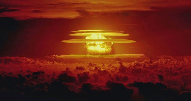
Since the first detonation of an atomic bomb in 1945, more than 2,000 nuclear weapons tests have been conducted by eight countries: the United States, the Soviet Union, the United Kingdom, France, China, India, Pakistan and North Korea.
Groups such as the Comprehensive Nuclear-Test-Ban Treaty Organization are constantly on the lookout for new tests. However, for reasons of safety and secrecy, modern nuclear tests are carried out underground – which makes them difficult to detect. Often, the only indication they have occurred is from the seismic waves they generate.
In a paper published in Geophysical Journal International, my colleagues and I have developed a way to distinguish between underground nuclear tests and natural earthquakes with around 99% accuracy.
Fallout
The invention of nuclear weapons sparked an international arms race, as the Soviet Union, the UK and France developed and tested increasingly larger and more sophisticated devices in an attempt to keep up with the US.
Many early tests caused serious environmental and societal damage. For example, the US’s 1954 Castle Bravo test, conducted in secret at Bikini Atoll in the Marshall Islands, delivered large volumes of radioactive fallout to several nearby islands and their inhabitants.
Between 1952 and 1957, the UK conducted several tests in Australia, scattering long-lived radioactive material over wide areas of South Australian bushland, with devastating consequences for local Indigenous communities.
In 1963, the US, the UK and the USSR agreed to carry out future tests underground to limit fallout. Nevertheless, testing continued unabated as China, India, Pakistan and North Korea also entered the fray over the following decades.
How to spot an atom bomb
During this period there were substantial international efforts to figure out how to monitor nuclear testing. The competitive nature of weapons development means much research and testing is conducted in secret.
Groups such as the Comprehensive Nuclear-Test-Ban Treaty Organization today run global networks of instruments specifically designed to identify any potential tests. These include:
- air-testing stations to detect minute quantities of radioactive elements in the atmosphere
- aquatic listening posts to hear underwater tests
- infrasound detectors to catch the low-frequency booms and rumbles of explosions in the atmosphere
- seismometers to record the shaking of Earth caused by underground tests.
A needle in a haystack
Seismometers are designed to measure seismic waves: tiny vibrations of the ground surface generated when large amounts of energy are suddenly released underground, such as during earthquakes or nuclear explosions.
There are two main kinds of seismic waves. First are body waves, which travel outwards in all directions, including down into the deep Earth, before returning to the surface. Second are surface waves, which travel along Earth’s surface like ripples spreading out on a pond.
The difficulty in using seismic waves to monitor underground nuclear tests is distinguishing between explosions and naturally occurring earthquakes. A core goal of monitoring is never to miss an explosion, but there are thousands of sizeable natural quakes around the world every day.
As a result, monitoring underground tests is like searching for a potentially non-existent needle in a haystack the size of a planet.
Nukes vs quakes
Many different methods have been developed to aid this search over the past 60 years.
Some of the simplest include analysing the location or depth of the source. If an event occurs far from volcanoes and plate tectonic boundaries, it might be considered more suspicious. Alternatively, if it occurs at a depth greater than say three kilometres, it is unlikely to have been a nuclear test.
However, these simple methods are not foolproof. Tests might be carried out in earthquake-prone areas for camouflage, for example, and shallow earthquakes are also possible.
A more sophisticated monitoring approach involves calculating the ratio of the amount of the energy transmitted in body waves to the amount carried in surface waves. Earthquakes tend to expend more of their energy in surface waves than explosions do.
This method has proven highly effective for identifying underground nuclear tests, but it too is imperfect. It failed to effectively classify the 2017 North Korean nuclear test, which generated substantial surface waves because it was carried out inside a tunnel in a mountain.
This outcome underlines the importance of using multiple independent discrimination techniques during monitoring – no single method is likely to prove reliable for all events.
An alternative method
In 2023, my colleagues and I from the Australian National University and Los Alamos National Laboratory in the US got together to re-examine the problem of determining the source of seismic waves.
We used a recently developed approach to represent how rocks are displaced at the source of a seismic event, and combined it with a more advanced statistical model to describe different types of event. As a result, we were able to take advantage of fundamental differences between the sources of explosions and earthquakes to develop an improved method of classifying these events.
We tested our approach on catalogues of known explosions and earthquakes from the western United States, and found that the method gets it right around 99% of the time. This makes it a useful new tool in efforts to monitor underground nuclear tests.
Robust techniques for identification of nuclear tests will continue to be a key component of global monitoring programs. They are critical for ensuring governments are held accountable for the environmental and societal impacts of nuclear weapons testing.![]()
Mark Hoggard, DECRA Research Fellow, Australian National University
This article is republished from The Conversation under a Creative Commons license. Read the original article.


